Predicting landslides - Entwicklung von Gefahrenhinweiskarten für Hangrutschungen aus konsolidierten Inventardaten
The goal of the gAia project is to generate hazard-warning maps for landslides. The project therefore aims to develop a methodology to improve and amend existing landslide occurrence data by remote-sensing data. Such data originates from heterogeneous sources and will therefore be fused and harmonized in order to create a comprehensive data-inventory.
Based on the existing, as well as newly generated remote-sensing data, a prediction model will be created utilizing the modern artificial intelligence (AI) techniques in order to estimate the probability of a landslide occurrence. This prediction model will serve as a base for the generation of landslide-warning maps for two of the Austrian federal states (Lower Austria & Carinthia).
Motivation
On the 12th of October 2021, the consortium consisting of 7 partners kicked-off the gAia project – a research project that aims to develop maps highlighting at-risk area for landslides.
The project focus is on creating high-quality data inventories for landslides. The detection of possible at-risk areas for landslides is crucial, as such land-movements pose a threat to the safety of the population and can potentially cause great damage to infrastructure. The development of up-to-date, comprehensive information about the likelihood of occurrence is crucial in order to act in time and avert potential risks at an early stage.
Within gAIa, modern artificial intelligence (AI) methods will be applied in order to predict the potential likelihood of landslide occurrence. This way, policy makers and civil protection authorities will be equipped with the generated information, which should subsequently facilitate their decision-making in preventing damage caused by landslides. For this purpose, the newly generated information from the airborne-laser-scanning (ALS) elevation models, and multispectral, optical satellite data (Sentinel-2) will thus be fused and harmonized with the current landslide land-registry data.
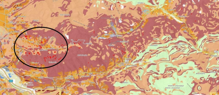
Machine learning (ML) techniques and deep learning (DL) architectures will be employed to develop a prediction model for the probability of occurrence of landslides to allow for the creation of a comprehensive data-inventory for two of the Austrian federal states (Lower Austria & Carynthia).
SBA Research takes on the leading role in the gAia project. Further tasks of SBA Research also include the AI supported data fusion and quality-control. Furthermore, SBA will take part in creating the landslide prediction model, as well as the landslide visualization. The FAIR data management of the geo-data as well as the auditability of the generated inventory will be ensured by the SBA‘s Team.
Dissemination Activities
gAia was introduced in an article in the Austrian Press Agency Science Journal. The full article can be found here https://science.apa.at/mehrzumthema/prognosen-sind-schwierig-besonders/
A contribution to the Disaster Research Days 2022 Conference was made by the gAia team, where the project was presented. The contribution was subsequently published here https://newslettertogo.com/5ggppbdj-erx5ncb6-od7krvdi-nyo
Project Lead
SBA Research gGmbh
Project Partners
- SBA Research gGmbH – Project Lead
- Zentralanstalt für Meteorologie und Geodynamik (ZAMG)
- Austrian Institute of Technology (AIT)
- GeoVille Information Systems and Data Processing GmbH (GeoVille)
- Disaster Competence Network Austria (DCNA)
- Geologische Bundesanstalt (GBA)
- Bundesministerium für Landesverteidigung (BMLV)
Links
Further description of the project, along with the contact information of our project partners, can be found on the KIRAS website under the following link: https://www.kiras.at/en/financed-proposals/detail/predicting-landslides-entwicklung-von-gefahrenhinweiskarten-fuer-hangrutschungen-aus-konsolidierten-inventardaten
Contact
gAia is funded by the Federal Ministry of Agriculture, Regions and Tourism.